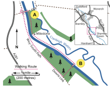
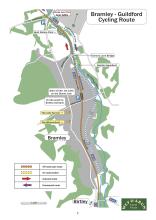
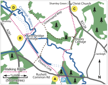
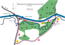
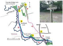
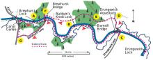
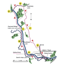
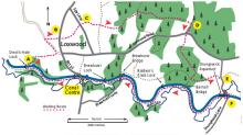
Walking & Cycling Routes
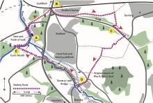
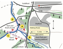
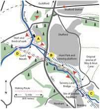
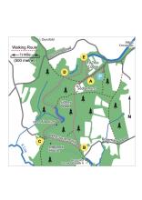
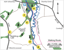
The countryside around the route of the Wey & Arun Canal is arguably amongst the most attractive for walking in the south of England. The Canal passes through the lovely woodland and open landscapes of Surrey and West Sussex, including areas of outstanding natural beauty. We have compiled some guides to short walks around several areas of the canal including Shalford at the northern end, Birtley (near Bramley), Alfold and a variety of walks in and around Loxwood.
If you like a longer challenge or live further away, then we have also published a guide to the Wey-South Path, a walking route of some 36 miles linking the North Downs Way south of Guildford to the South Downs Way above Amberley. This and other books, souvenirs and clothing are available from our online shop.
The thumbnail maps shown below should give you an idea of the routes; click on a map to see the full route, and a link to download a printable version